Lobster Like a Pro
The fishing and lobstering app built for South Florida and the Keys: high-resolution shaded relief, thousands of proven spots, no-take zones, 4,500+ artificial reefs, and daily ocean data to plan your day on the water.
- 3,000+ proven lobster spots, Haulover Inlet to Key West
- 4,500+ Florida artificial reefs, free for everyone
- Clearly marked no-take zones
- Free ocean layers like sea surface temp and altimetry, updated daily
- High-resolution bathymetry shaded relief charts
Take the tour
Everything you need, from the dock to the dive
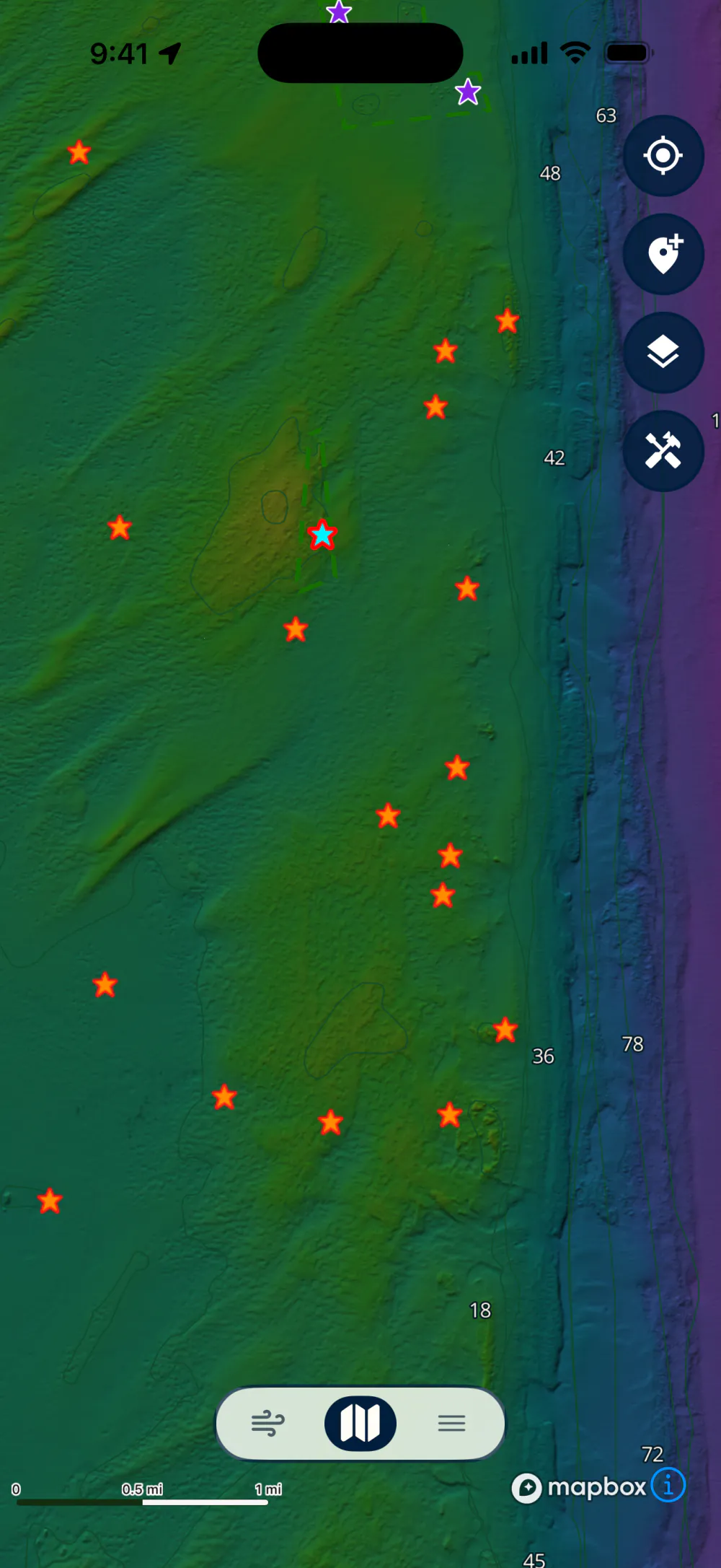
Find your favorite spot
3,000+ proven spots, Haulover to Key West
Every premium waypoint is rated by difficulty and comes with a short description, so you'll know whether it's a shallow patch reef or a deep ledge before you ever splash.
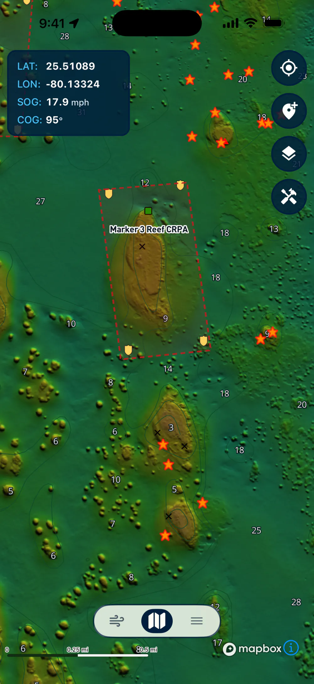
Stay legal
Know every boundary line before you dive in
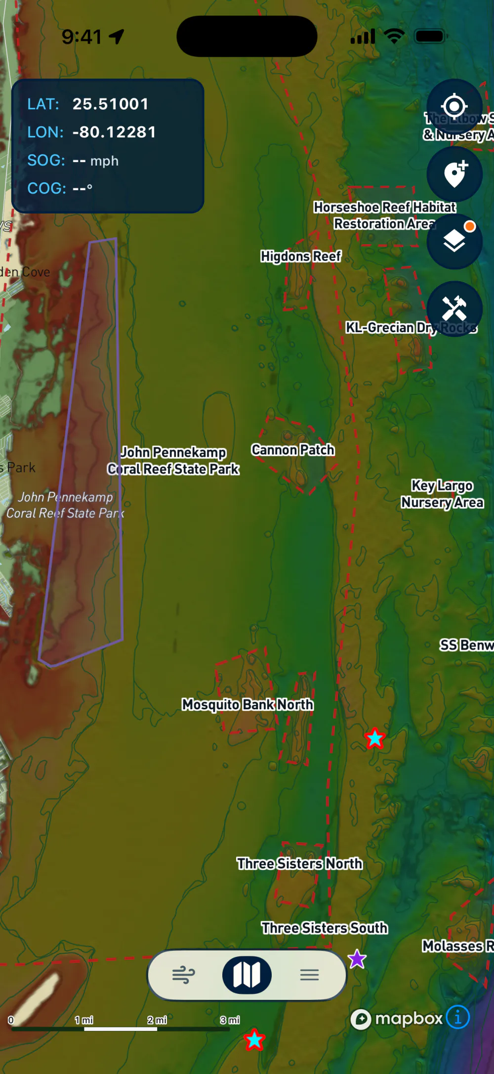
Sanctuary preservation areas, restoration sites, and other no-take zones are outlined right on the map. Tap any one to see what it protects and why lobstering stops at its edge.
Get there
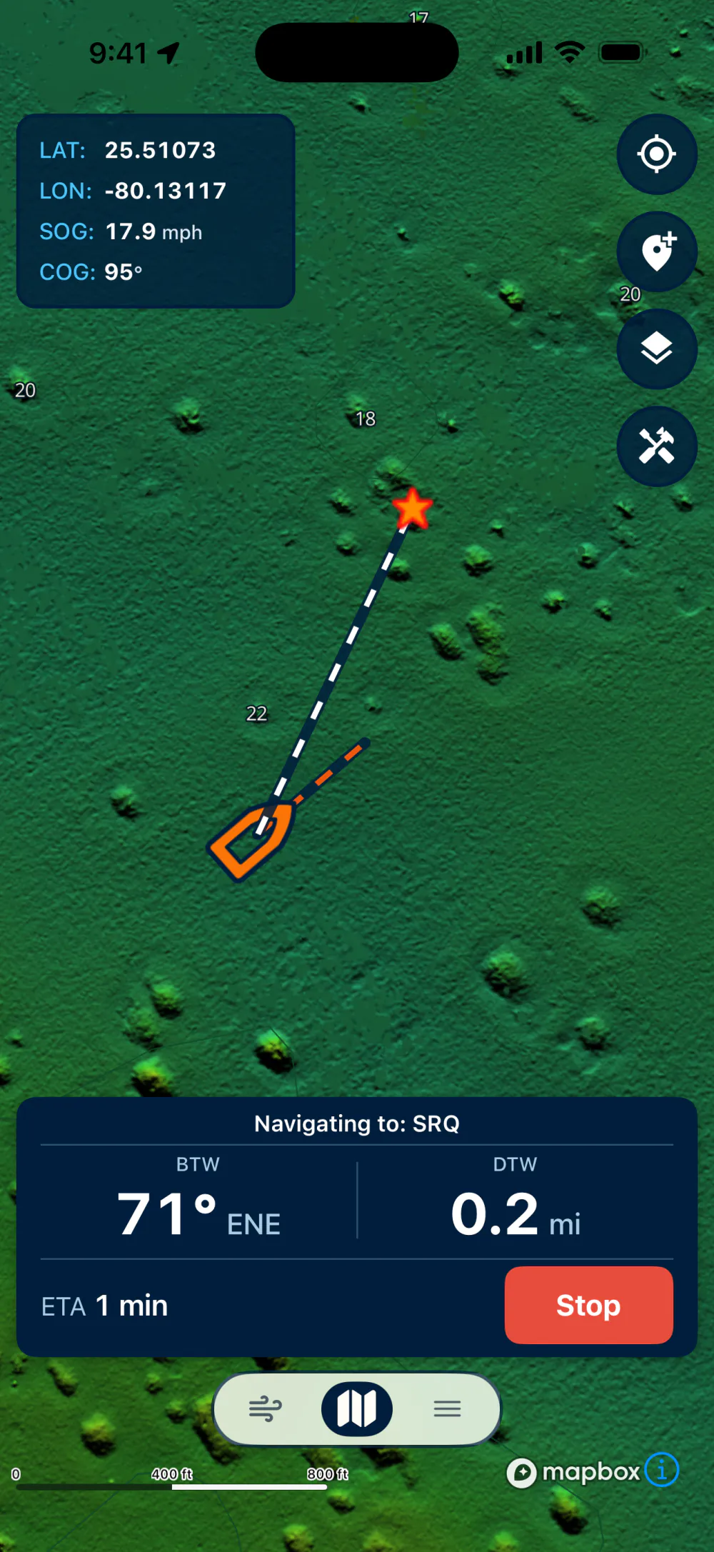
Run straight to the spot, even offline
Pick a waypoint and Lobsterly charts your course with live bearing, distance, and ETA. It all keeps working offline, so a dropped signal never costs you the spot.
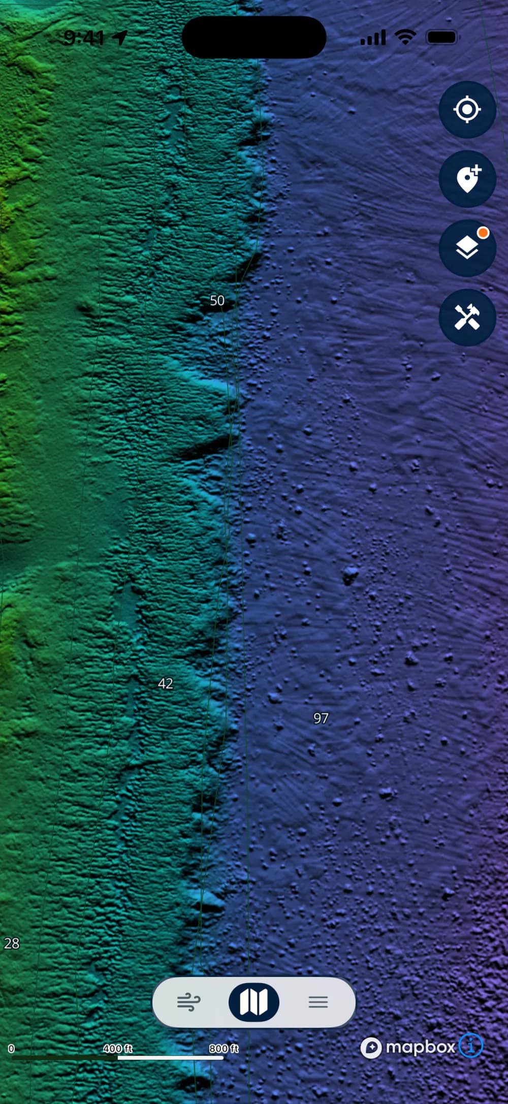
See the bottom
Watch the reef drop from 40 to 90 feet
Lobsterly Bathymetry
High-resolution shaded relief makes ledges, coral heads, and wrecks stand out, so you can find the exact spot before you get wet or drop a line.
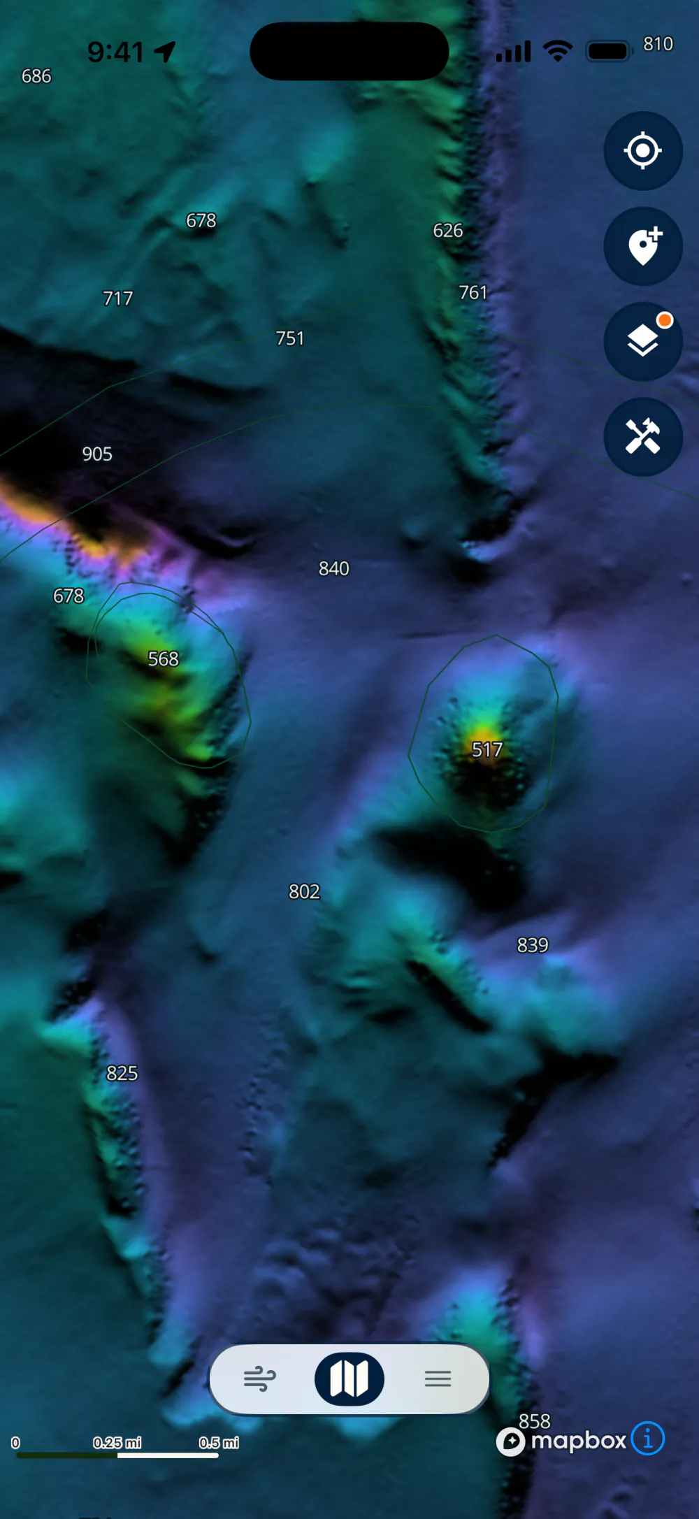
Explore new areas
Fishing somewhere new? Scout it first
Lobsterly Bathymetry
Explore unfamiliar water ahead of time with shaded relief charts on your phone, then download the area for offline use.
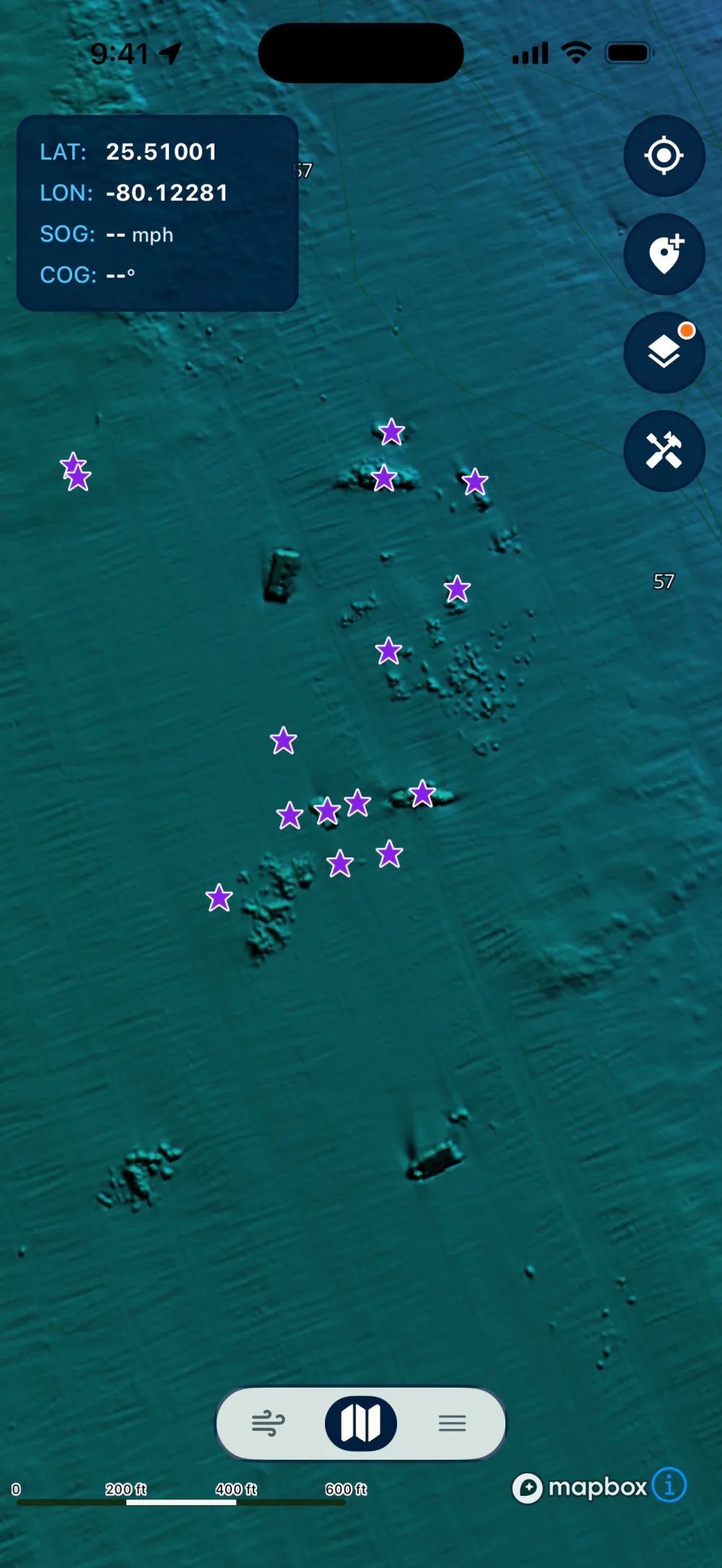
Hit the wrecks
4,500+ of Florida's public artificial reefs
Wrecks, rubble piles, and reef modules from Pensacola to Key West. Choose the regions you dive and filter by depth to find structure that suits your plan.
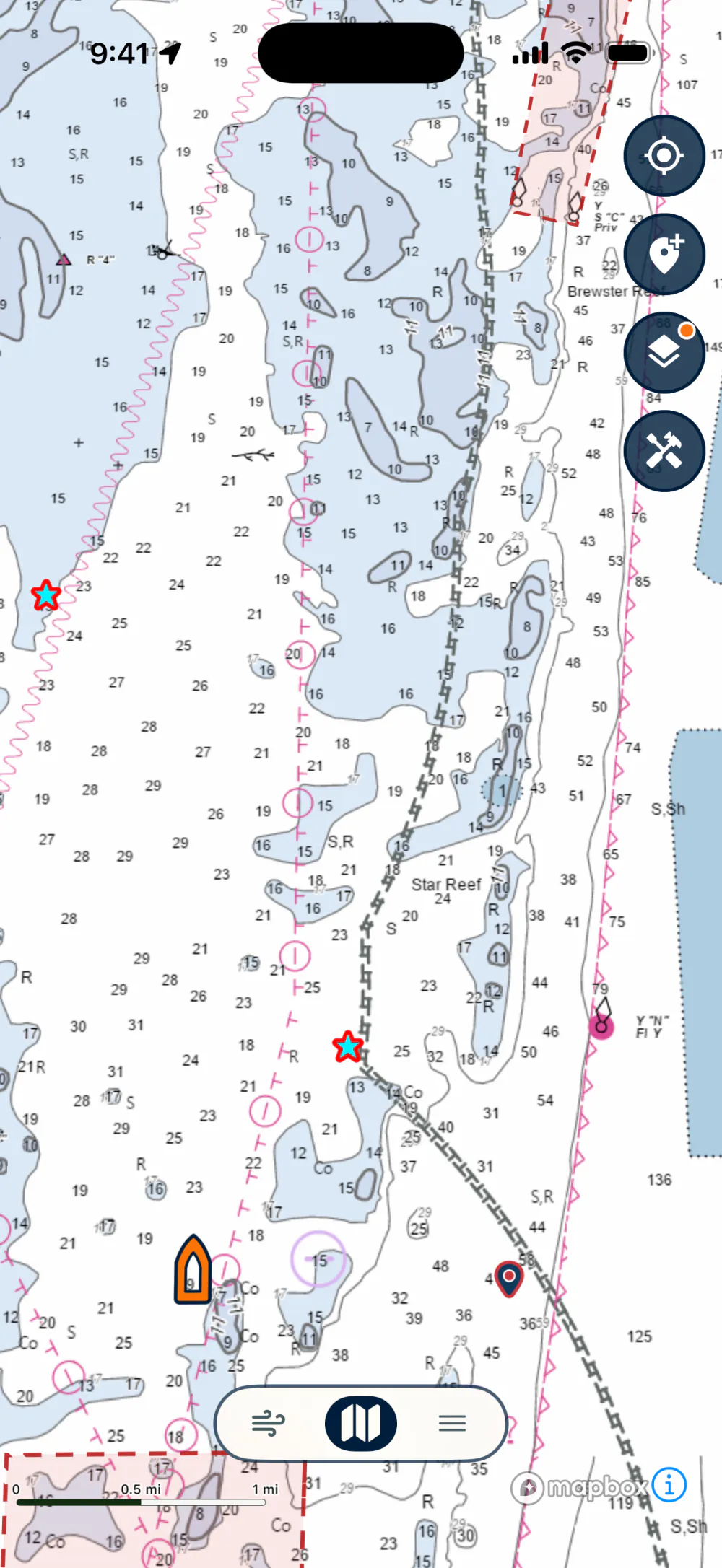
Navigate with confidence
NOAA nautical charts, one tap away, included free
Flip to the chart view for soundings, channels, and aids to navigation whenever you're running the boat rather than hunting.
Where should you fish today?
Six ocean layers refresh every day from satellite data, showing you where warm water, clean water, and current edges are setting up before you leave the dock. Drop a waypoint with a layer on, and Lobsterly saves that day's reading right alongside it.
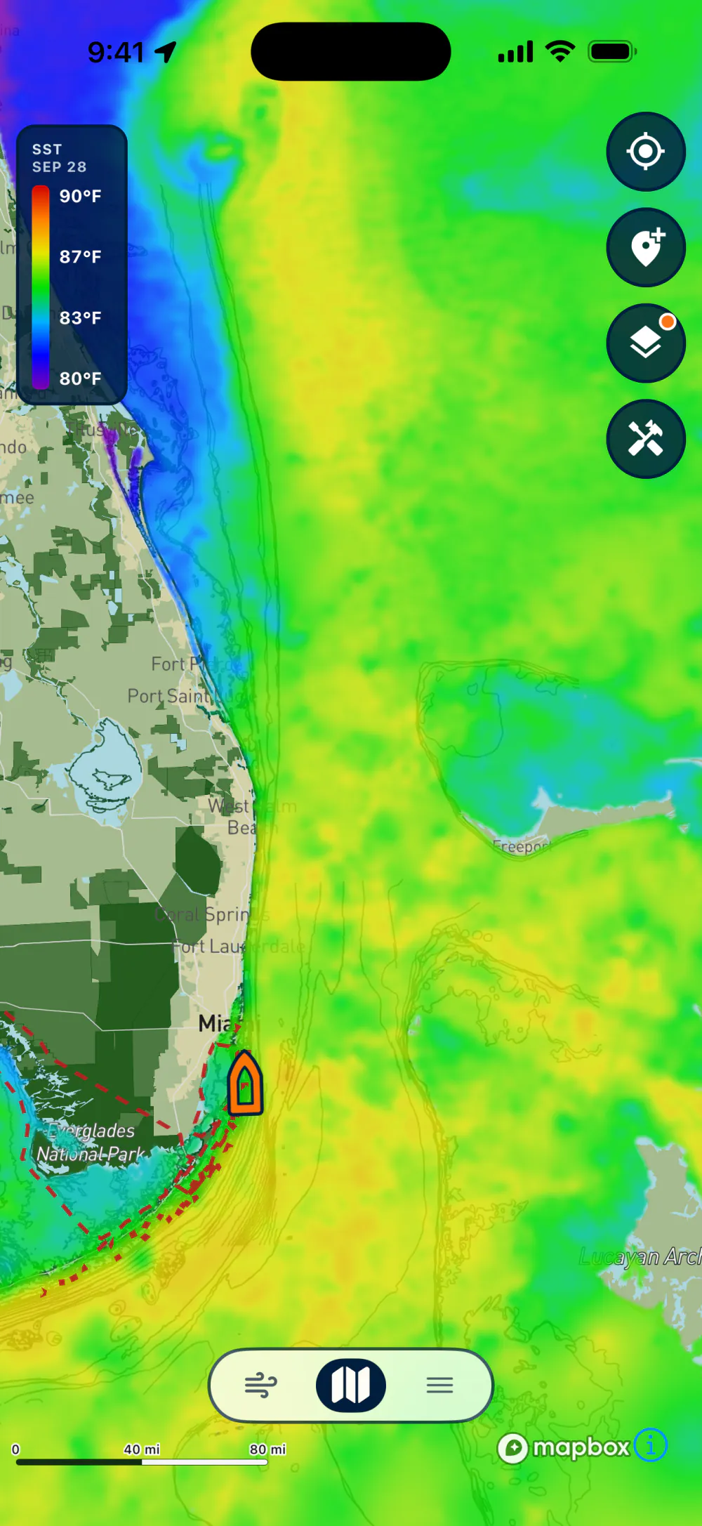
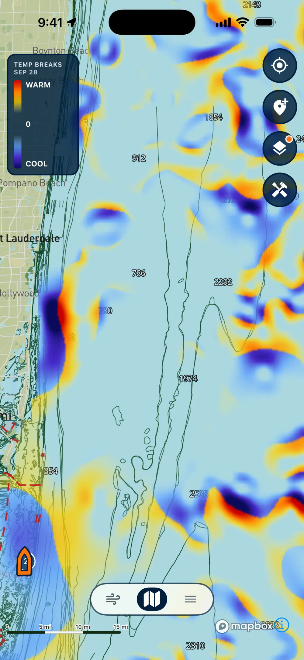
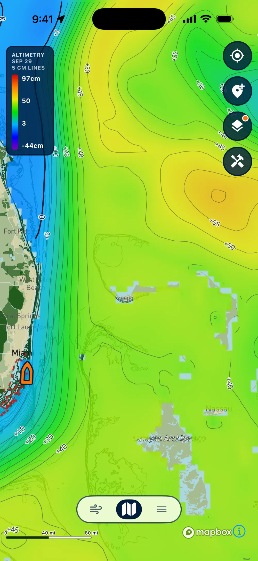
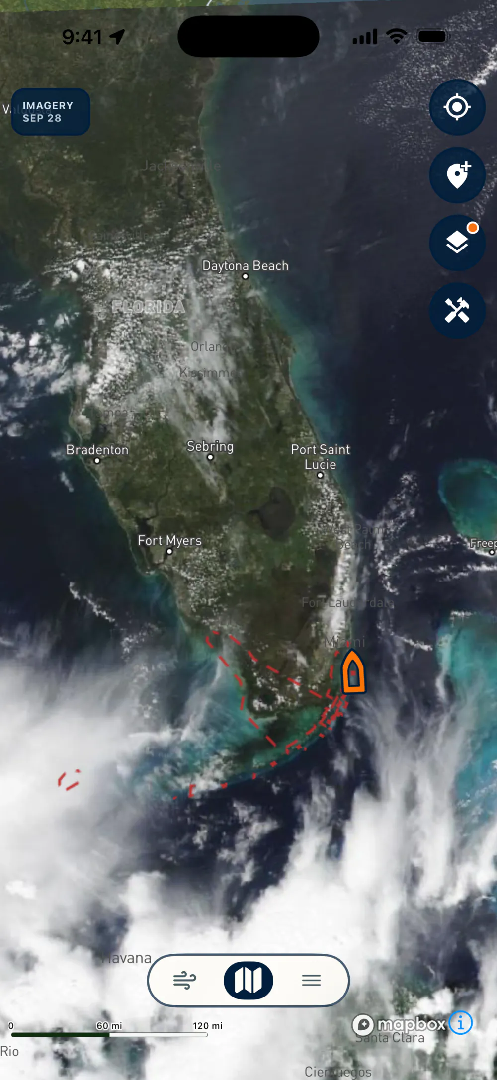
Daily water temperature at 1 km resolution, with the color scale fit to the water that's out there today, so even a 2-degree edge stands out.
Also included: Chlorophyll and Altimetry Breaks.
Lobsterly: What's Inside
Premium Waypoints (One-time unlock, no subscription)
- ✓ 3,000+ curated waypoints to lobster spots
- ✓ Lobster Spots: Haulover Inlet to Key West
- ✓ Precise coordinates to put you right on a limit
- ✓ Every spot rated by difficulty with a description
- ✓ Coral heads, ledges, reefs, rocks, hardbottom & more
- ✓ Spots for all skill levels, even beginners
- ✓ Lifetime updates to the waypoint database
- ✓ Everything in Free, included
Free
- ✓ Real-time, fully offline navigation
- ✓ Interactive No-Take Zones (Miami-Dade & Monroe)
- ✓ Productive Lobster Zones: St. Lucie Inlet to Key West
- ✓ 100+ free waypoints to lobster spots
- ✓ 4,500+ Florida public artificial reefs, filterable by county & depth
- ✓ 6 daily ocean layers: Sea Surface Temp, Temp Breaks, Chlorophyll, Altimetry & more
- ✓ Add & save your own spots anywhere
- ✓ Trip Log & Lobster Tracker to count your catch
- ✓ Export waypoints & trip logs to CSV
- ✓ Nautical charts, satellite imagery & dark mode
- ✓ Reusable Pre-Trip Checklist
- ✓ Detailed lobster regulations & advanced tips
Unlock All Waypoints, or Just Where You're Diving
Waypoints are a one-time purchase, never a subscription.
Only diving one area? Unlock a single region for $19.99:
Already own a region? Upgrade to all waypoints for just $14.99.
High-resolution shaded relief of the bottom, plus offline map downloads for the area you draw.
Renews yearly. Cancel anytime from your App Store or Google Play account.
- Over 4,000 square miles surveyed at 1 meter resolution
- Nearly 10,000 square miles at 4 meters or better
- Composed of 55 separate LiDAR and multibeam sonar surveys
- Built for your phone or tablet. No chartplotter or chip required
- Easily mark, save, and export waypoints
- Download maps for offline use
Where it covers
- South Florida and the Keys. Detailed coverage extends from Miami's Government Cut to Rebecca Shoal, west of the Marquesas.
- Florida's Atlantic coast. Nearshore waters, to 25 feet deep, are well covered to Sebastian Inlet, with excellent reef and wreck coverage extending to roughly 250 feet deep as far north as Jupiter Inlet.
- Southwest Florida. Strong nearshore and inshore coverage extends from Marco Island to Boca Grande Pass, with additional surveys farther offshore.
- Tampa Bay and Cape Canaveral. Both areas include extensive offshore survey coverage.
- Dry Tortugas and Pulley Ridge. Coverage south and west of the Dry Tortugas, as well as some coverage of Pulley Ridge.
One subscription covers every area listed here. There are no sub-regions to buy separately.
Bathymetry is a picture of the bottom, not a navigation chart. Use the free NOAA chart layer or another current official chart to navigate.
Ready to dive in?
Install Lobsterly and limit-out on your next trip.
Have questions first? Read the Support & FAQ.